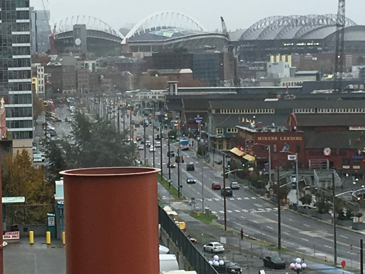
Arriving from Alaska, I’m surprised at the change of the Seattle waterfront–the Alaska Way viaduct is gone! I commuted on this rickety old elevated highway for 20 years to the Pike Place Market–and have to say, it sported some of the best commuting views in the nation. I’ve fully supported tearing it down and going with a tunnel–thus reclaiming nearly 2 miles of waterfront. Increased property taxes will pay for this in no time….
 My goal is to drive down to Jackson Hole and turn out the lights after my rapid departure in August, and plant a few trees. I get more than I bargained for as a pipe has burst causing a bit of sheet-rock damage. Here is the vista near the Idaho National Laboratories between Arco and Idaho Falls. INL is a breeder reactor run by the Department of Energy. Huge volcanic buttes line up in a perfect line from Craters of the Moon National Monument to Yellowstone Lake (an ancient caldera)–the continental crust is slowly over-riding (to the NE) the hot spot below punching up a new national park about every half million years (moving SW). There were three major eruptions that created the current geology/geography of Yellowstone: Huckleberry Ridge (-2.1M), Mesa Falls (-1.3M) and Lava Creek (-600K) which created Yellowstone Lake. As the hotspot moves SW relative to the surface, national monuments are created–Craters of the Moon is the latest. It’s a beautiful sunset drive with the magenta sun at my back for a good hour or more–80mph roadway.
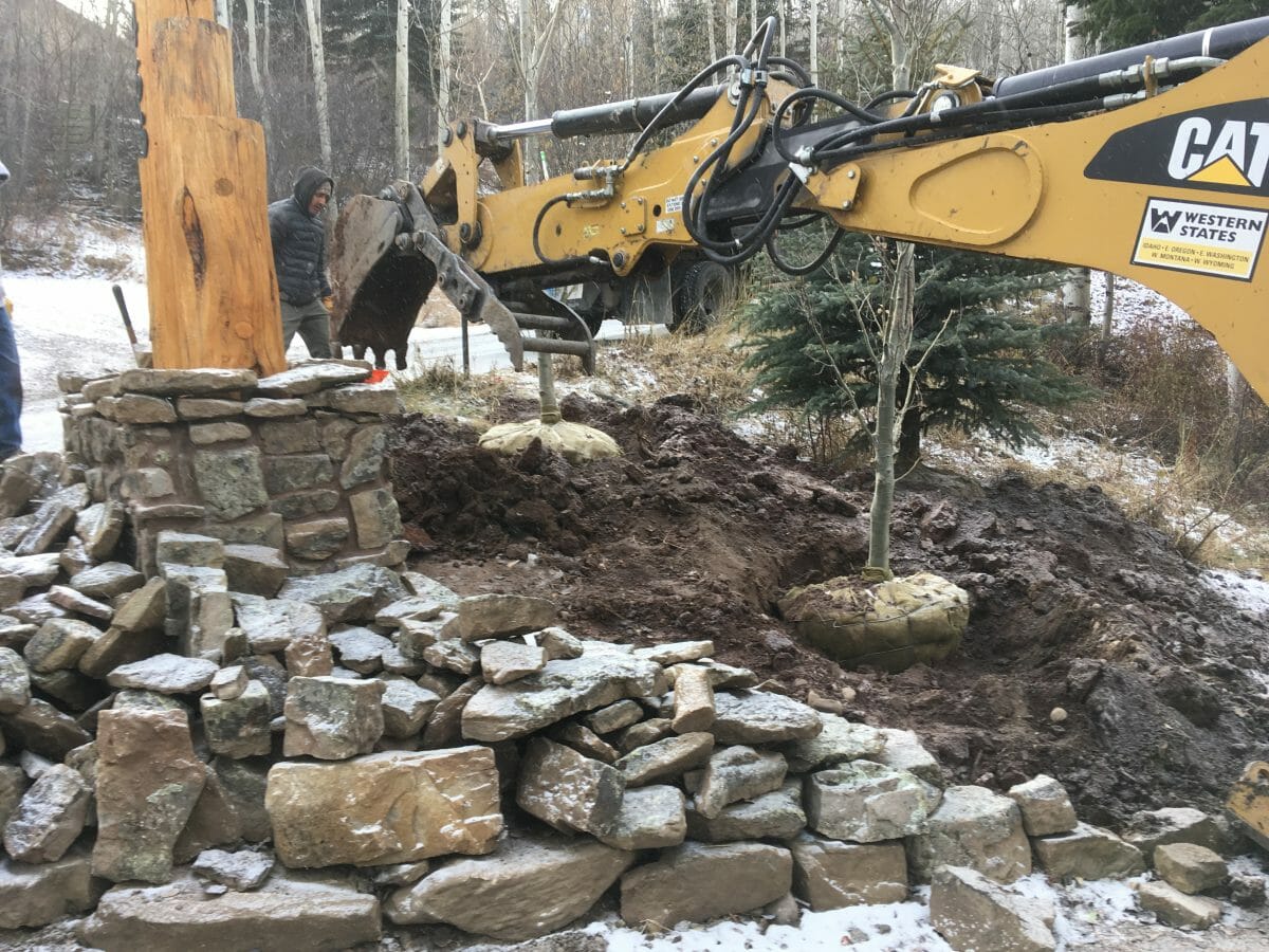
Time to plant trees; it’s been nearly 10 years since a**hole developers destroyed my driveway (see that post here, here and here). They took out 53 trees pushing the road upon to 12 feet into my property and elevating it 3′ to fix uphill neighbor’s properties. Thanks Jean, Matt, and Joe! Welcome to Saddle Butte–Home of the Selfish. Even though it’s minus 11 degrees, we get to work. I completed the log monument in August and need to flesh in some trees to screen our road. One large spruce, 10 aspen and four Hawthorne bushes. Here they come….
 Here’s the finished product, albeit without leaves.
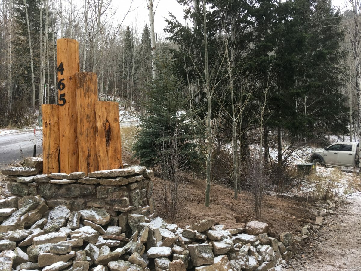 Custom fonts for the house numbers to be installed, also a steel reinforcing band….stay tuned for the finished product–you’ll love it….OK, enough.
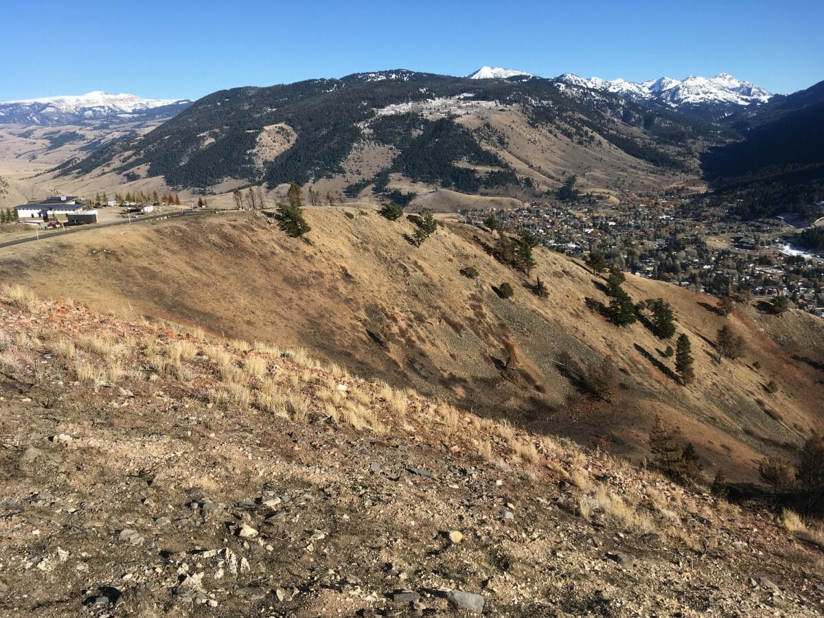
 I take a drive up to the summit (normally I walk) to observe the recent fire These folks are lucky–but they built steel houses and only 50′ apart! The fire burned most of the top of there ridge.
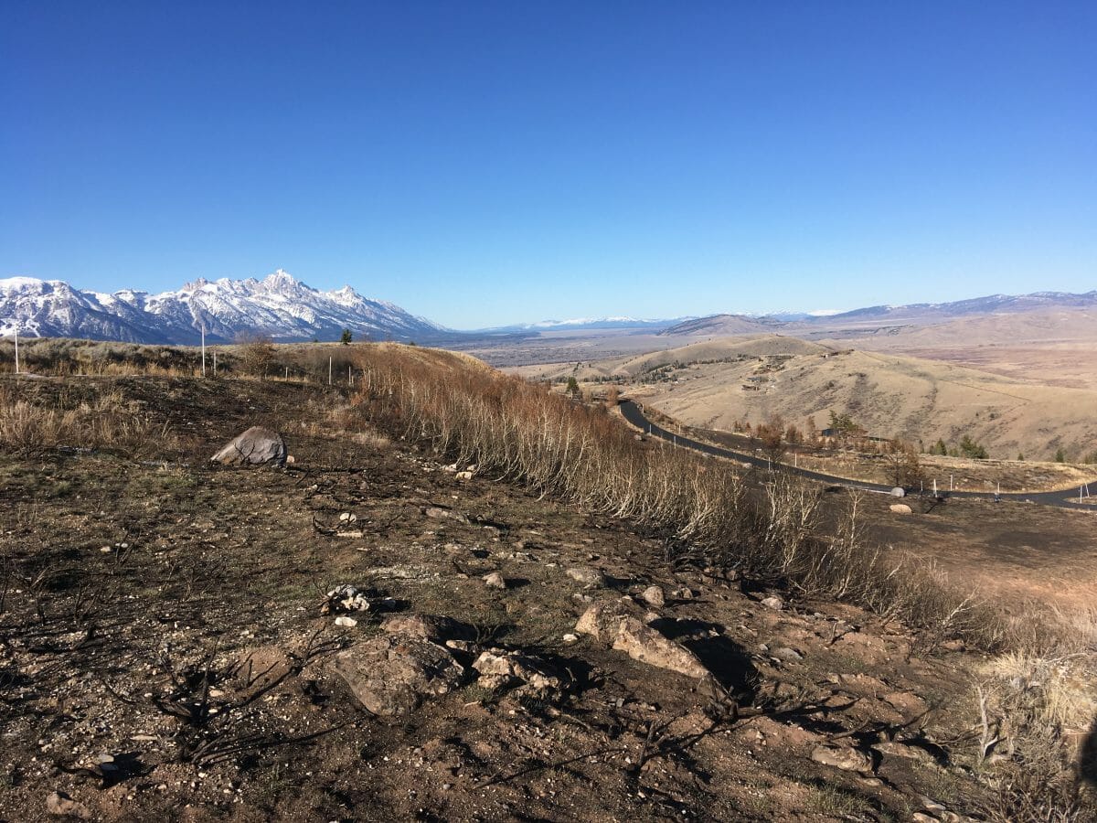 Looking north to the Tetons, the fire burned up over the ridge and down to the last hairpin turn, leaping this and stopping short of the house.
 The fire burned up from town (here looking SE), up this ravine like a chimney–in perhaps a half hour total.
 Ditto–top of the 2000′ chimney–this was ignited by mylar balloons released into a high voltage power line near the highway below. See my previous post for the actual burn.
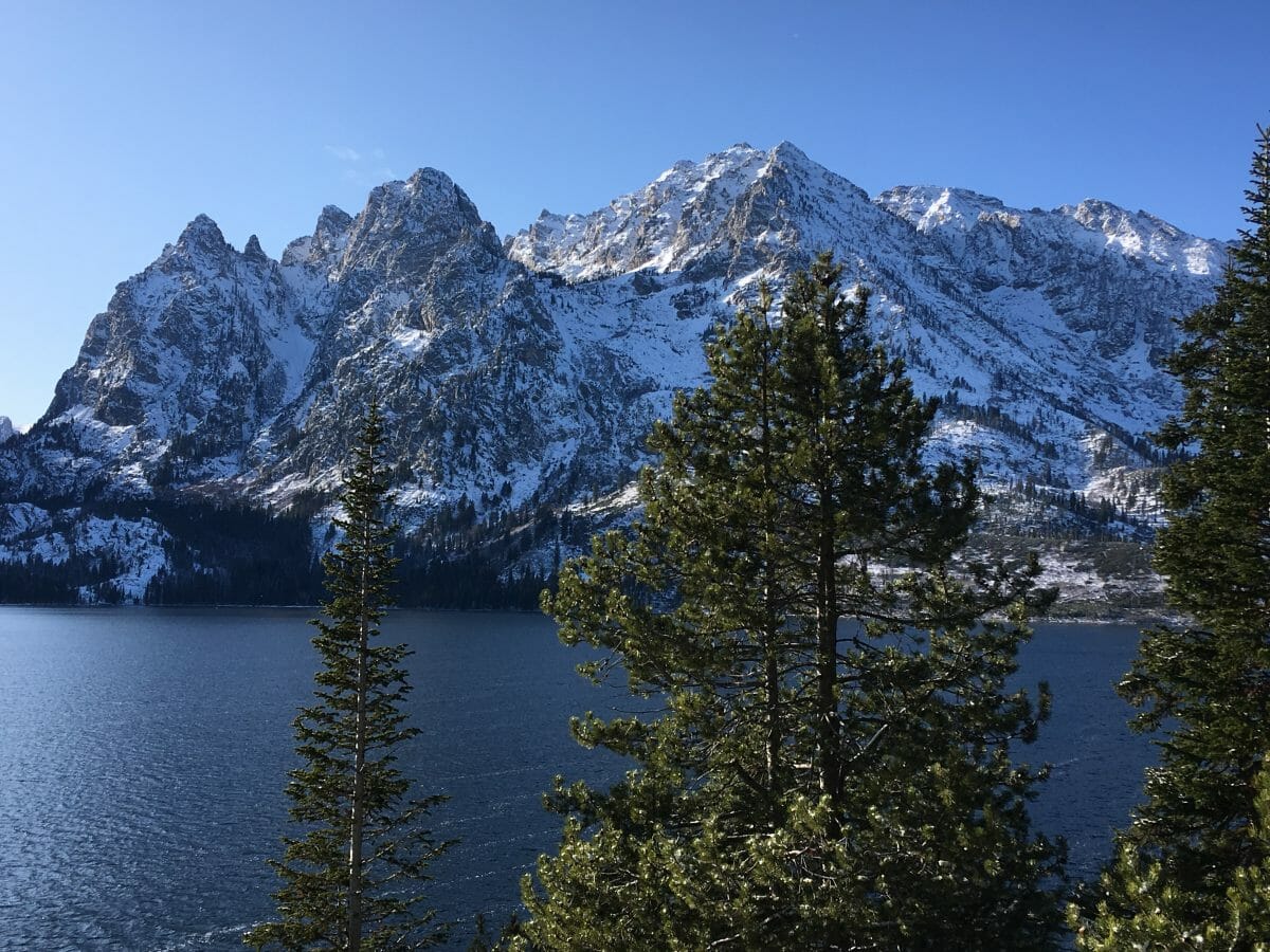
Time for a drive up to the park. Jenny Lake is nearly the geographic (and scenic) center of the National Park Service. There were times I believed the center of the universe was he ball-bearing swivel on my ranger desk chair. I worked here for 7 years in the 1970s, climbed here for three years earlier, and for another 40 years–for a total of 53 years. Storm Point on the left, Mount Woodring, named after the first Superintendent, is the summit on the very far right. Samuel Woodring was removed by Horace Albright for inappropriately touching his baby-sitter while driving her home from Moose to Jackson. Here is that story.

This is the perspective from the east shore of Jenny Lake from which the WPA artists created the first poster of our budding National. Park Service. Crooked Thumb, a northern rampart of Teewinot frames the left of this vista blending. into the NE ridge of Mt. Owen–Storm Point on the right. Jenny Lake is quite likely the most perfectly formed glacial lake in the world with crystal clear water replenished by Cascade Canyon, directly ahead, and Leigh Creek which flows from the north through String Lakes. The Jenny Lake Ranger Station is barely a mile south of this perspective and was my “office” for 7 years. I was paid to climb these mountains.
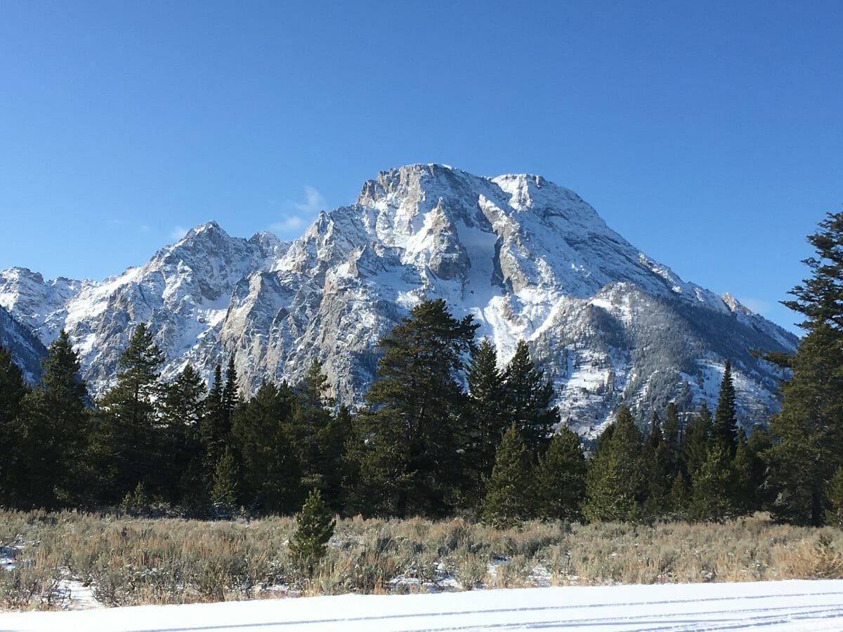 Mt. Moran, named after Thomas Moran, painter on the 1871 Hayden Expedition that mapped this region; albeit from the other side, is an absolute monolith in the Teton Range. The Flathead Sandstone formation sits proudly on its summit–early Cambrian beach deposits pushed up by following muds and silts, then later eroded off exposing this thin vestige of the beginning of our current geologic timeline. Jackson Hole represents nearly a complete geologic record from pre-Cambrian to the present–600M years. Consider that!
My drive through Yellowstone on November 3 was nearly the last car through the park. Here is a short pan from Steamboat Point on the north shore of Yellowstone Lake. Steam vents blow like cannons, vestiges of the Lava Creek eruption, with the Thorofare in the distance–one of the last and wildest places in the Continental US. Time to give animals a rest–I drive on to the East.
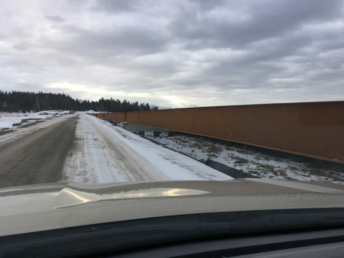 One final observation–this one plus mile monstrosity causeway built of an 8′ or more “I-beam” spanning a sensitive marshland on the north shore or Yellowstone Lake. Good grief–couldn’t the NPS re-route the roadway north a bit and give this back to there animals we’re charged with protecting? I exit out east toward Cody, then north to Powell, Laurel, spending the night in Missoula. I shifted from Doubletree to Holiday Inn when a crotch-sniffing dog drove me away at the front desk. I’ll post a blog on that soon–but don’t you hate all this PC stuff where you must share space with someone’s dog? Time to head back to Seattle and onward to Istanbul…..! Stay tuned!