The maps: Let’s start with the large Yosemite wall map, which I discovered during my research, and which is now safely stored in 8 sections at Castle Air Force Base in a large warehouse. Each panel is now on a wheel system which allows the staff to find out what is present and what is missing. After rereading the reports generated by Ansel Hall in 1934, the larger wall relief map was constructed in three segments; each containing four panels approximately 5′ tall X 7′ wide. With a little juggling on Google Earth, I found the approximately location of each panel:
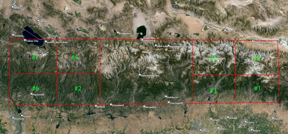
We are looking at the Sierra Nevada range with North on the left, Lake Tahoe top left and Mono Lake top center. Owen’s Lake has been plowed over into farmland. The green numbers are arbitrary as I photographed them on the warehouse floor. The center segment of four panels, which comprises Yosemite Valley, is missing ,however, here is a good photograph of it in situ:
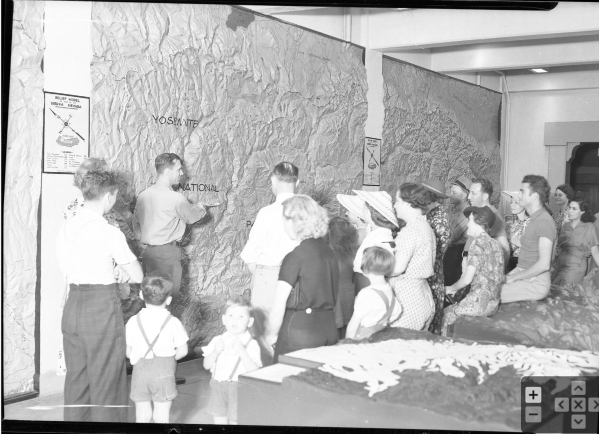
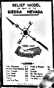
Note the poster on the left above the woman’s head–which shows the orientation to North. Here is that poster enlarged but unfortunately largely unreadable:
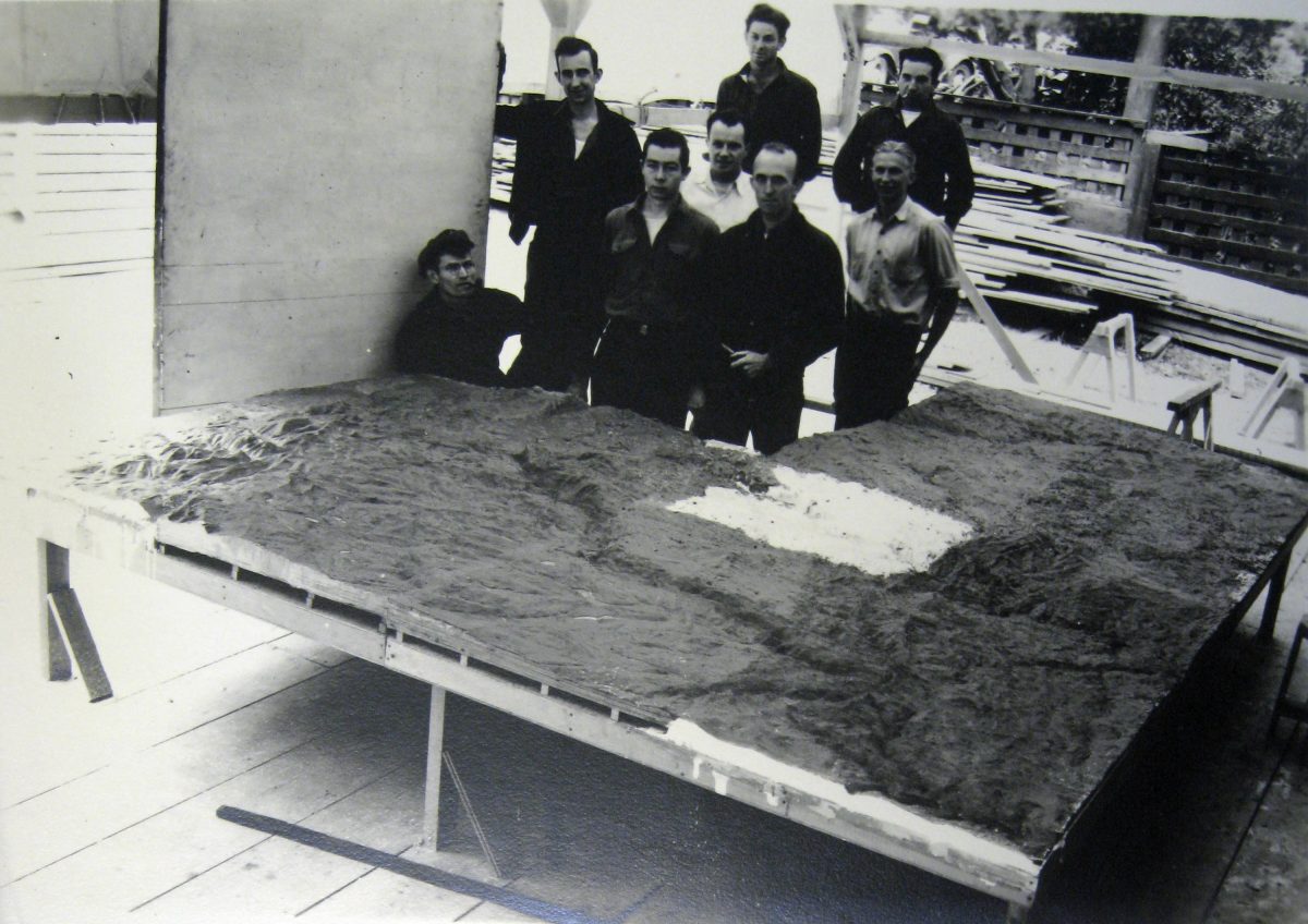
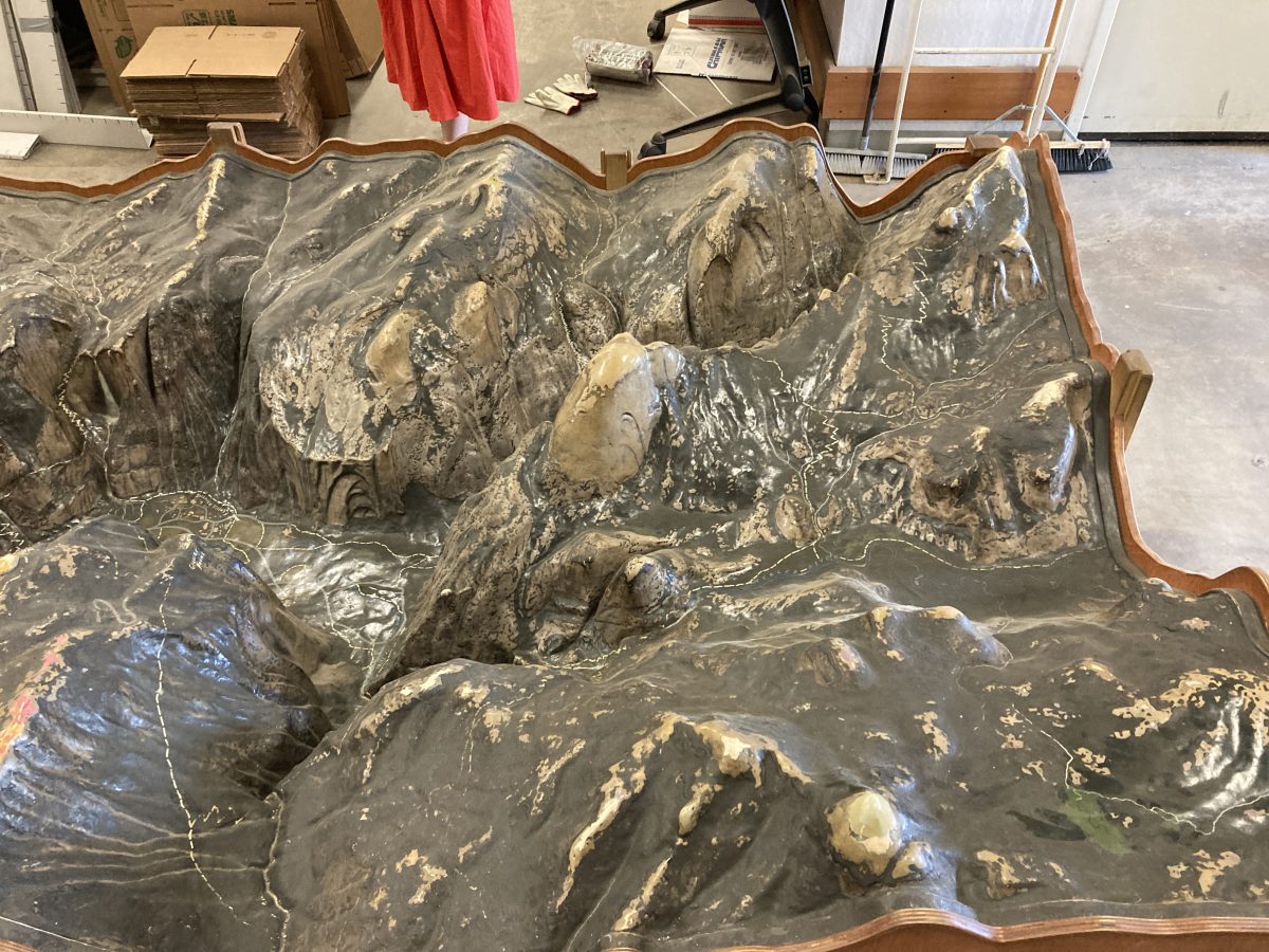
Ansel Hall was Chief Naturalist in the 1920s at Yosemite and was promoted to Chief Naturalist of the NPS with headquarters in San Francisco. He later was put in charge of the Western Museum Laboratories which was first funded in 1933-4. Naturally, his interest was in Yosemite where he had previously built a relief map–completed in 1923, before the WPA–in exaggerated relief which is shown below. Hall’s first order of business was to hand select about 35 CCC “boys” to craft this behemoth relief map portraying 250 miles of the Sierra mountain front. When built flat, the map was 7″ high with no vertical exaggeration. If this was a statue, it would be called the Statue of Liberty. Here is Hall’s description of this map in his annual report of 1934:
Here is the same wall today.
Ansel Hall hand selected 35 select CCC boys; here are 8 with the center section–now missing–in 1934.
This photo I found at San Bruno NARA archives which prompted my inquiries. Imagine my astonishment to learn they were still around. In about 1960, this map was removed and stored in a pole shed–open to the elements–until I visited there in 2022:
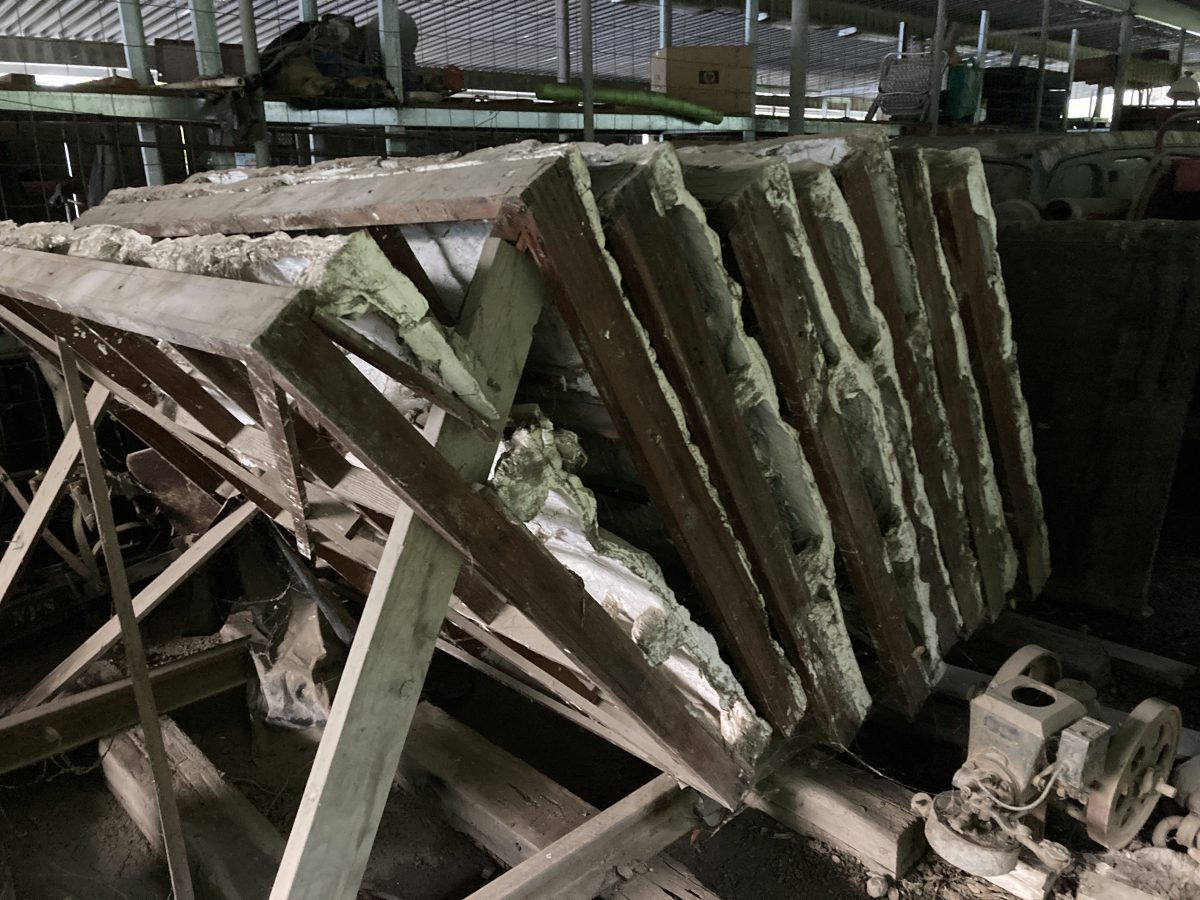
This was pretty heart-breaking to see them in this state; however they were not destroyed–at least 2/3’s of them. Here is one section showing the condition:
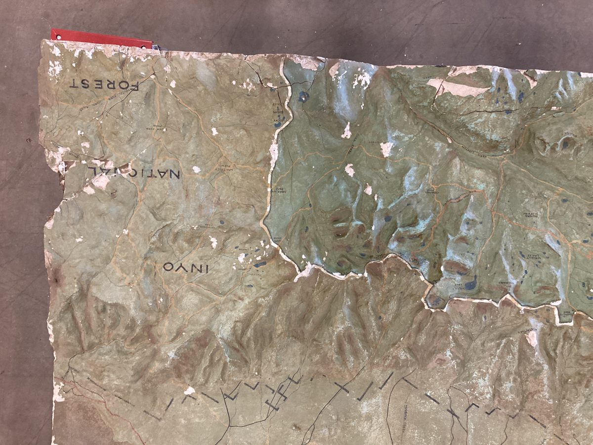
This is south of Mt. Whitney. Owen’s Lake is shown just above this small section. So, where are the center four sub-panels illustrating Yosemite National Park? Were they stored elsewhere? A media search will be necessary–perhaps they’re still in some retired park ranger’s basement, relics of a project never finished. So, on to the 1923 map built by Ansel Hall:
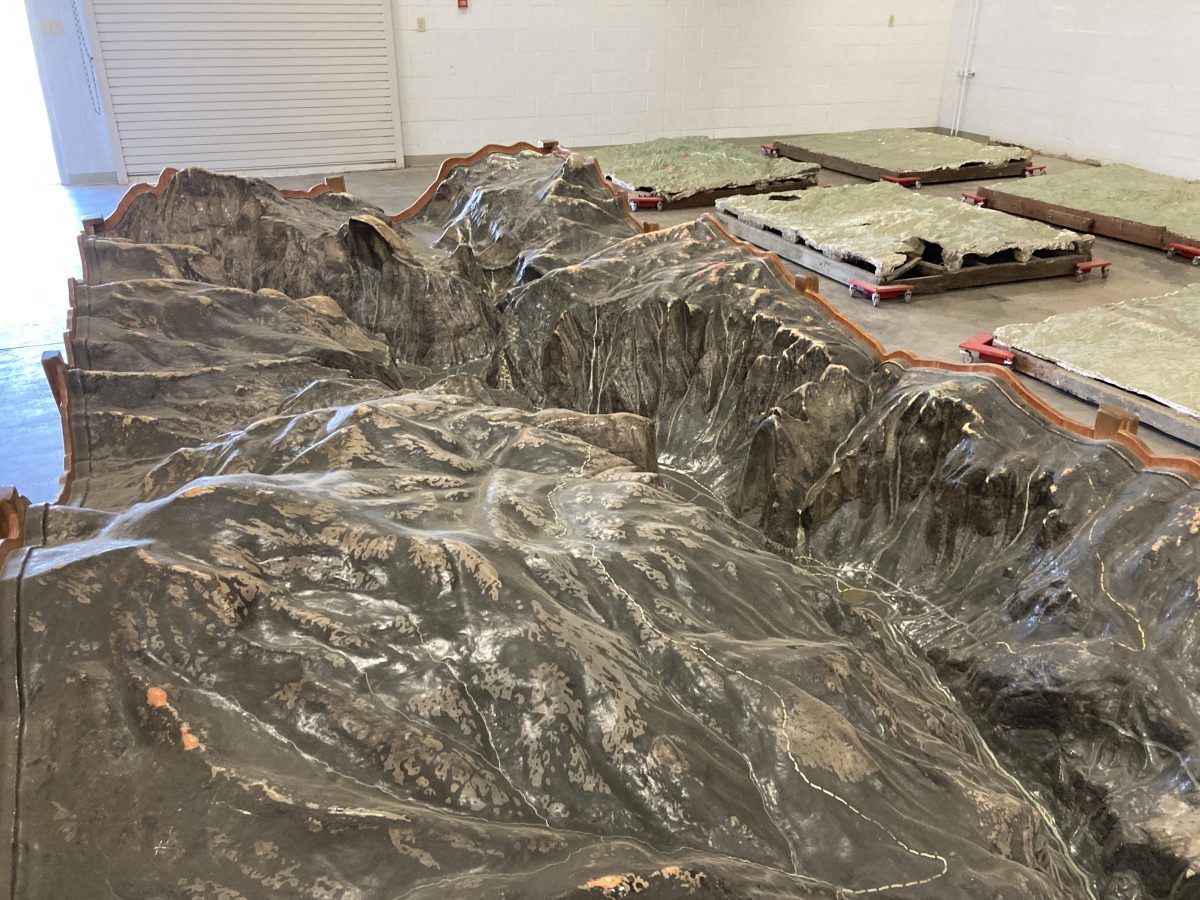
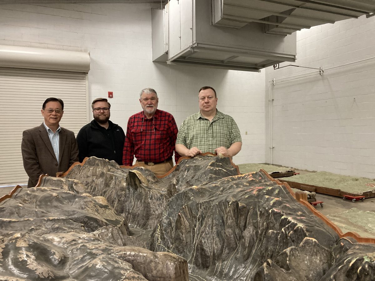
This discovery was nothing short of phenomenal and I was in the right spot at the right time. I called about the country desperately looking for a new for a new home for this. Measuring 125″ long X 57″ wide and 35″ tall, and weighing in at under 1000 lbs., my first thought was it was too big for my garage. It is made of plaster and is largely hollow. Note the larger relief map sections laying beyond.
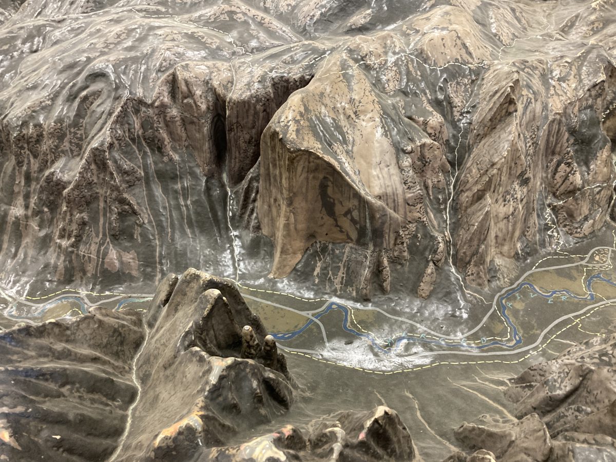
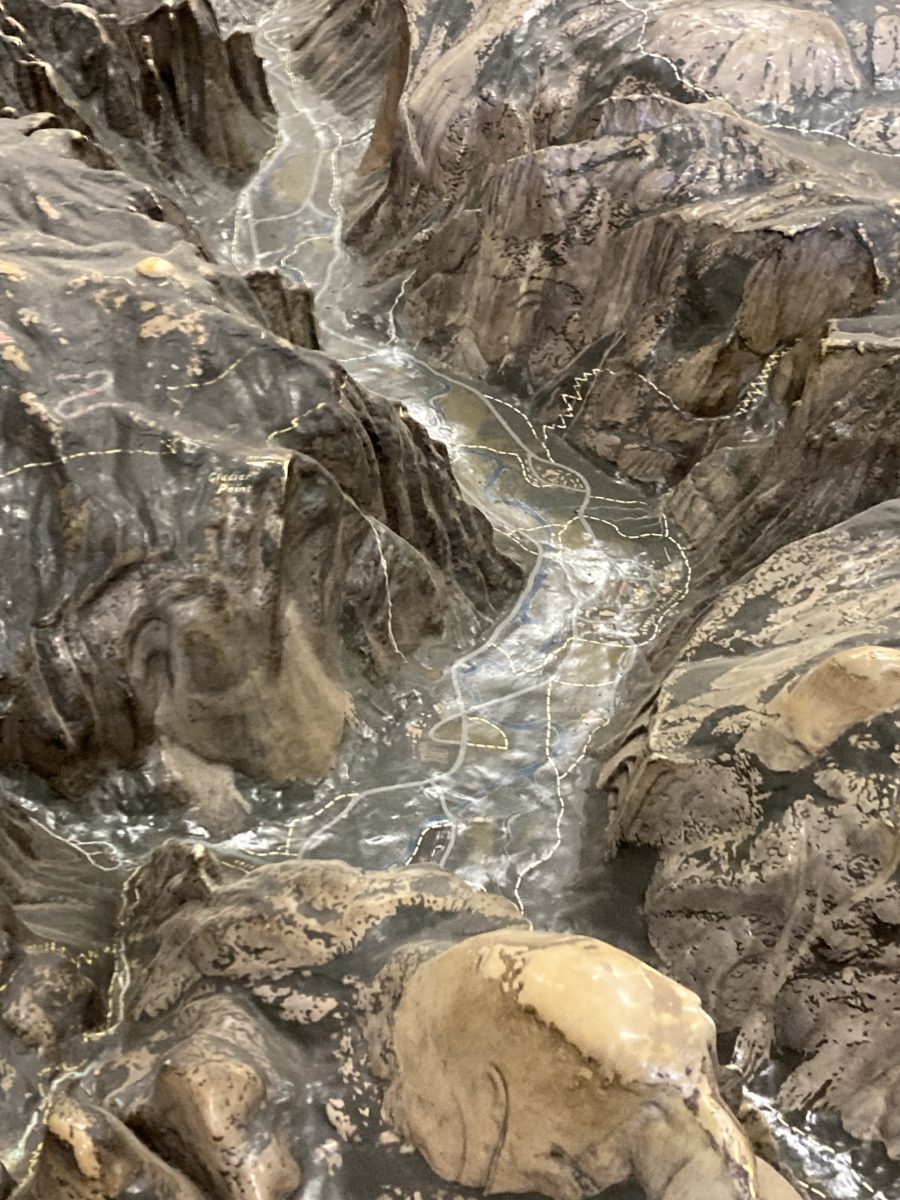
This is in exaggerated relief; perhaps 2X or 3X. Here El Capitan is shown over Cathedral Spires looking northward. The detail is phenomenal.
Above: Half Dome–I’ve climbed it.
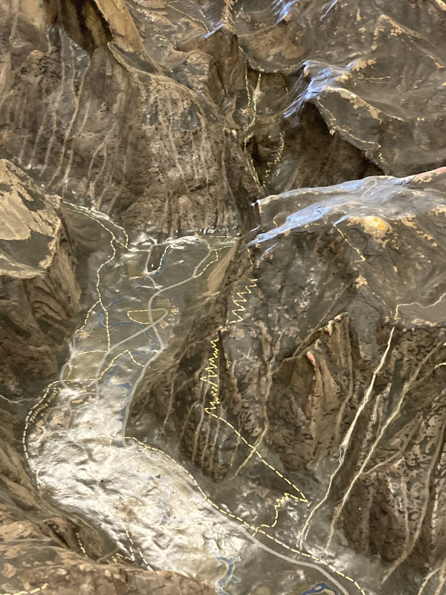
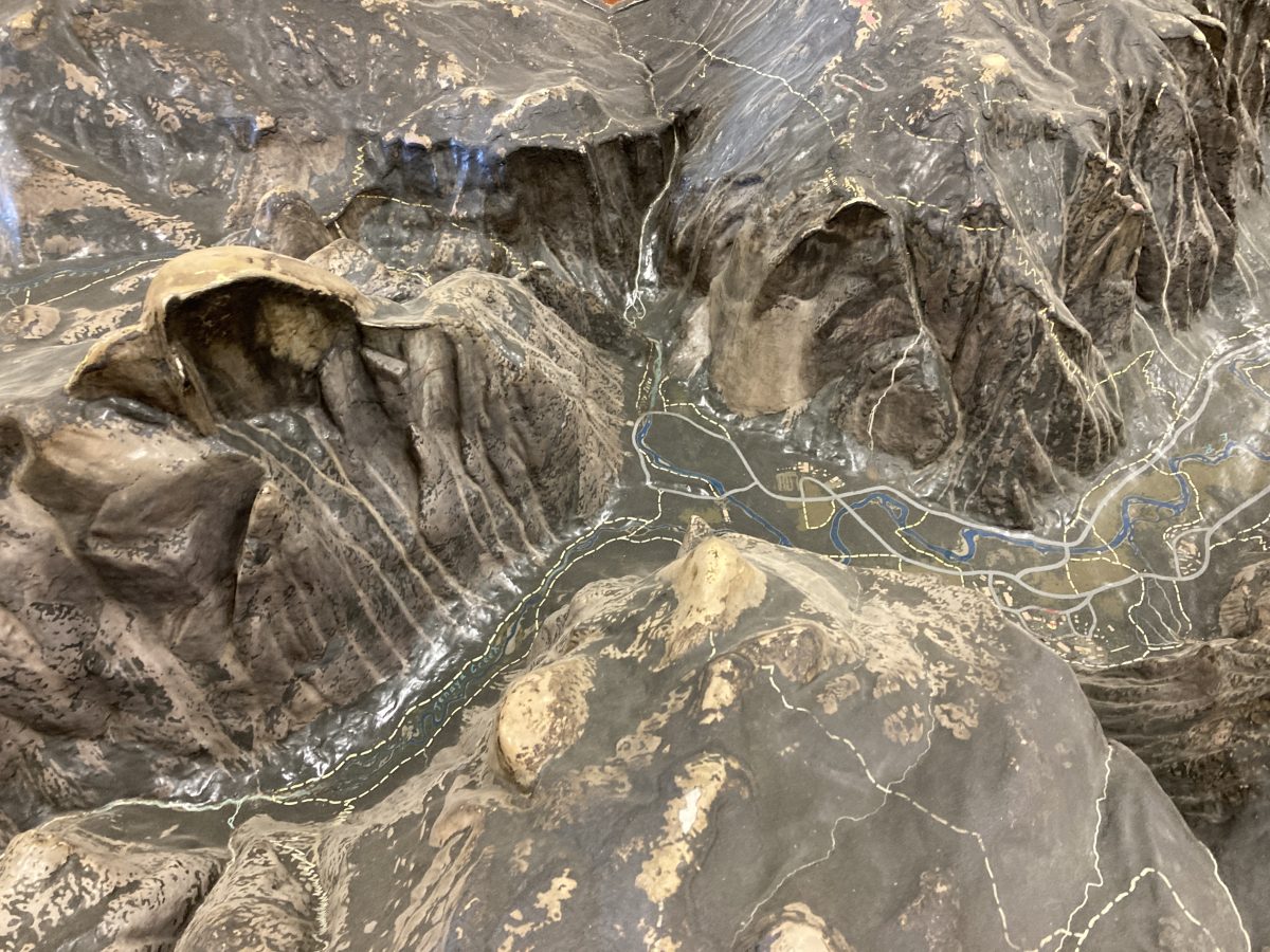
Details of the dizzying trail systems above the meandering roads and pathways on the valley floor.
Thousands of fingers have also “climbed” this peak. This map sat for exactly 100 years as the centerpiece for the Yosemite Museum’s Geology Room. Every climber who has ever visited this valley has run their fingers over these same summits. 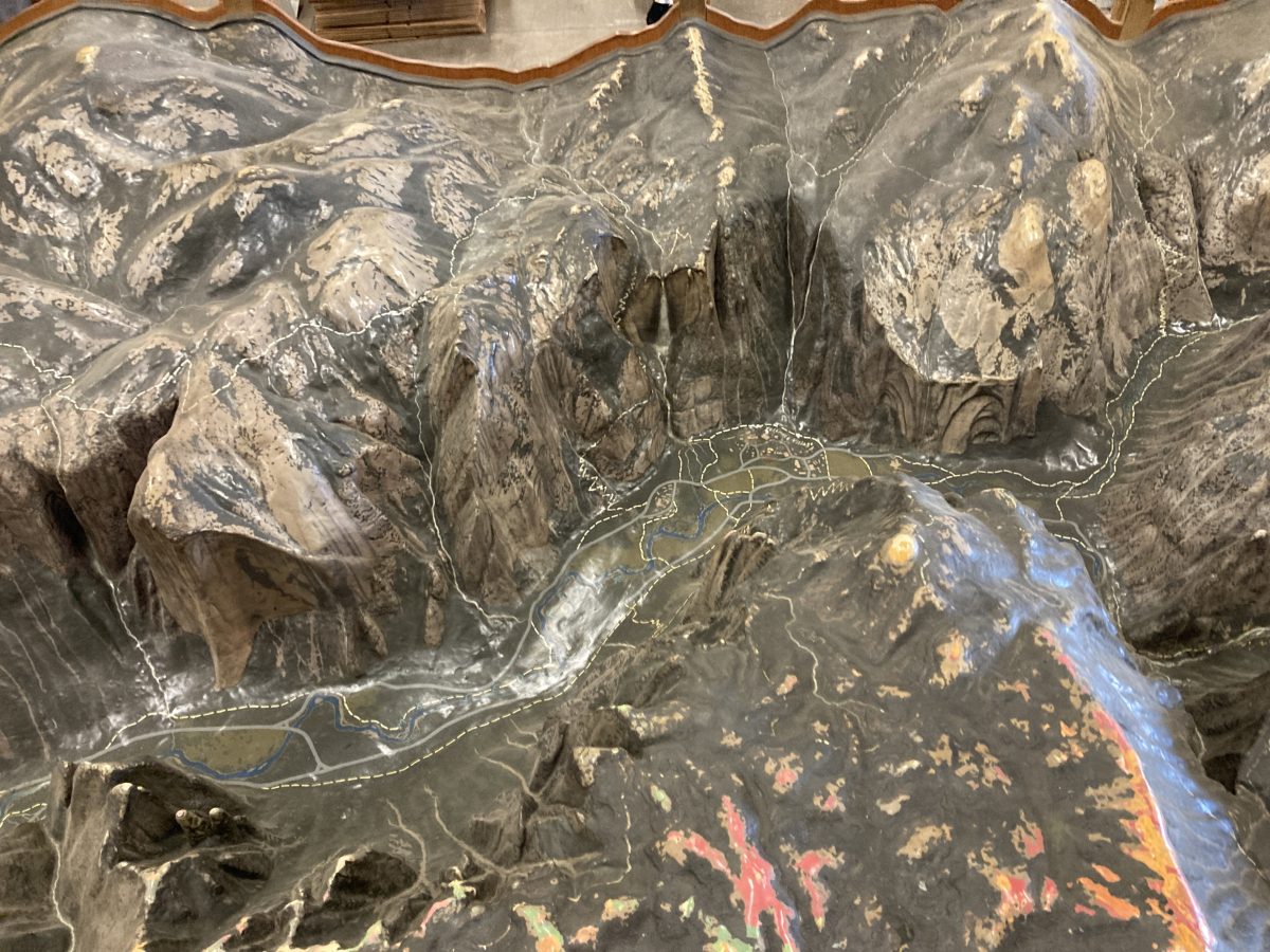
El Capitan on the left rising 3000′. The first ascent of the small white line, “the Nose,” was accomplished by Warren Harding, Wayne Merry, and George Whitmore in 1958–an epic climb.d Yosemite was changed forever.
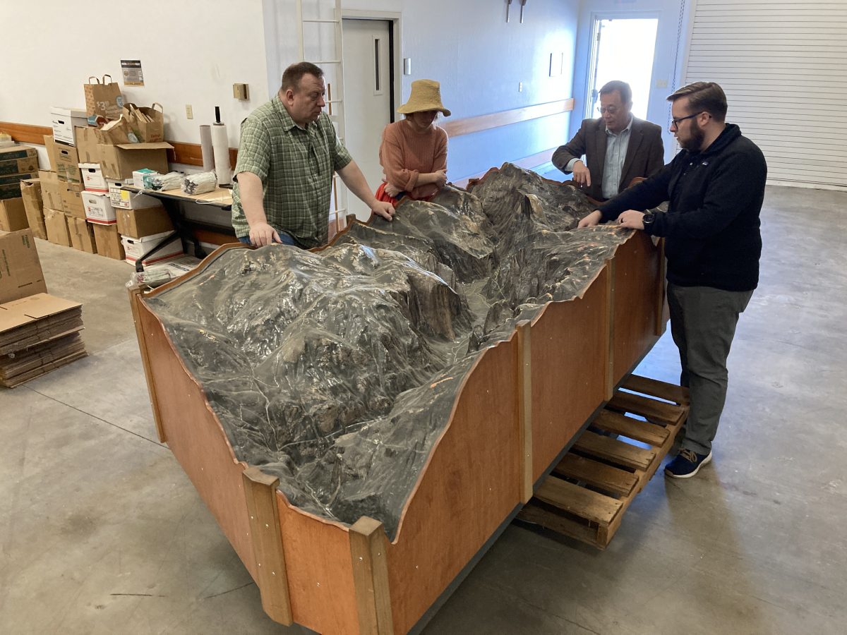
Here, the UC Merced Library staff ponders its destiny–perhaps the new centerpiece for their stunning library (also museum).
There were others made–this one, also showing Yosemite Valley, was crafted in 1926 and will be repurposed nearby.
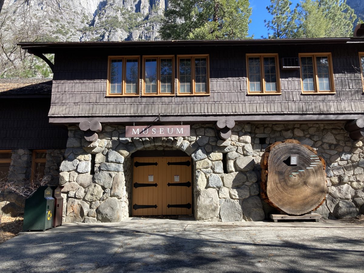
Perhaps the most iconic building in Yosemite, built in 1926 under Ansel Hall’s supervision, is the Yosemite Museum, which housed these two maps. What will replace them? I recently met with some members of Congress to see if the WPA products produced by our National Parks could be preserved–afterall, we paid for them. Perhaps the subject of my next book. Stay tuned!
BREAKING NEWS!
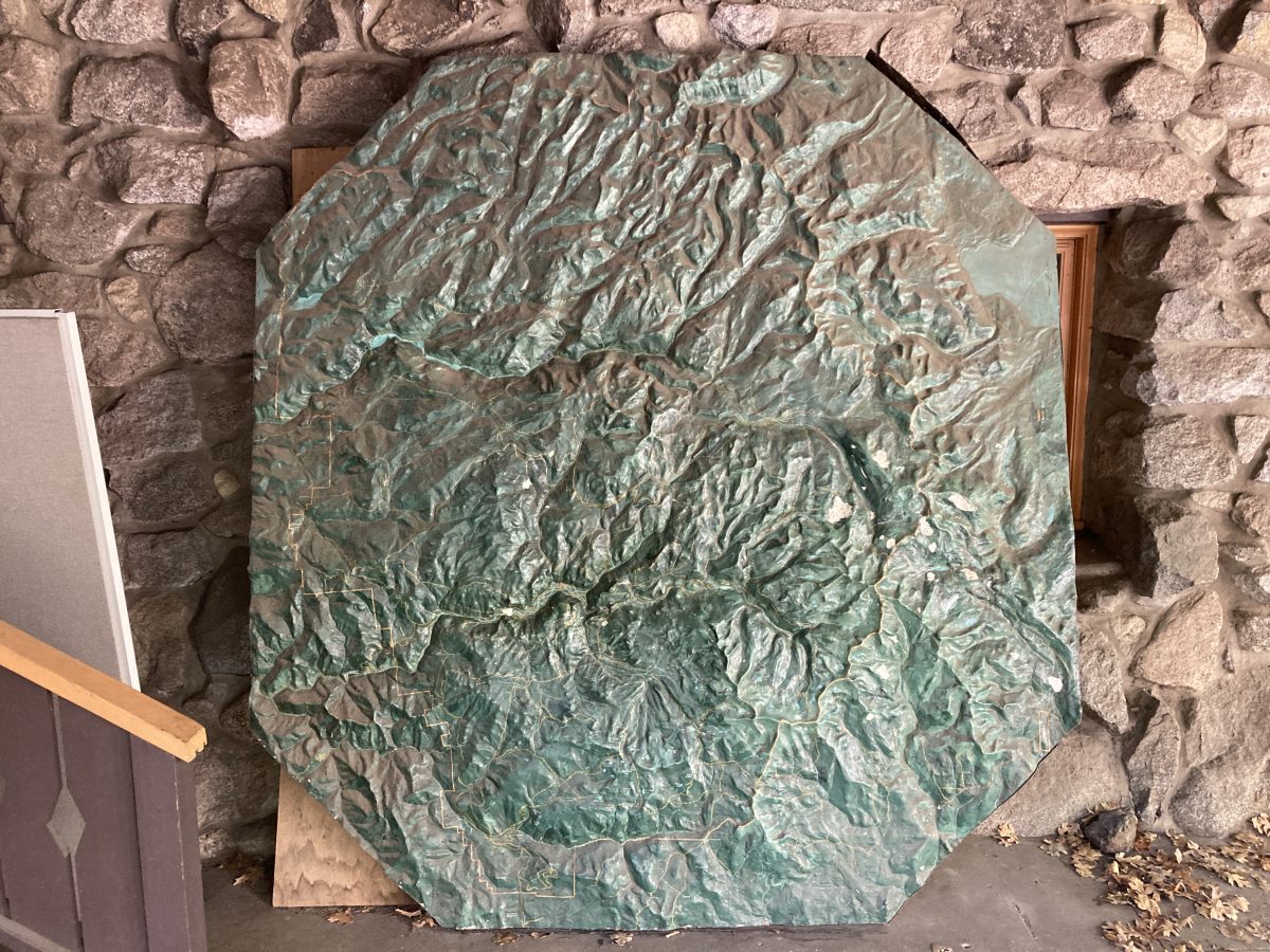
The center section has been found! It is housed in the USFS Mono Lake Visitors Center in Lee Vining CA and mounted horizontally so visitors can walk around it. Sadly the corners were sniped off:

Stay tuned!