There is very little snow this year so both Yellowstone and Grand Teton are plowing roads a month early. I take advantage and walk the road for exercise.
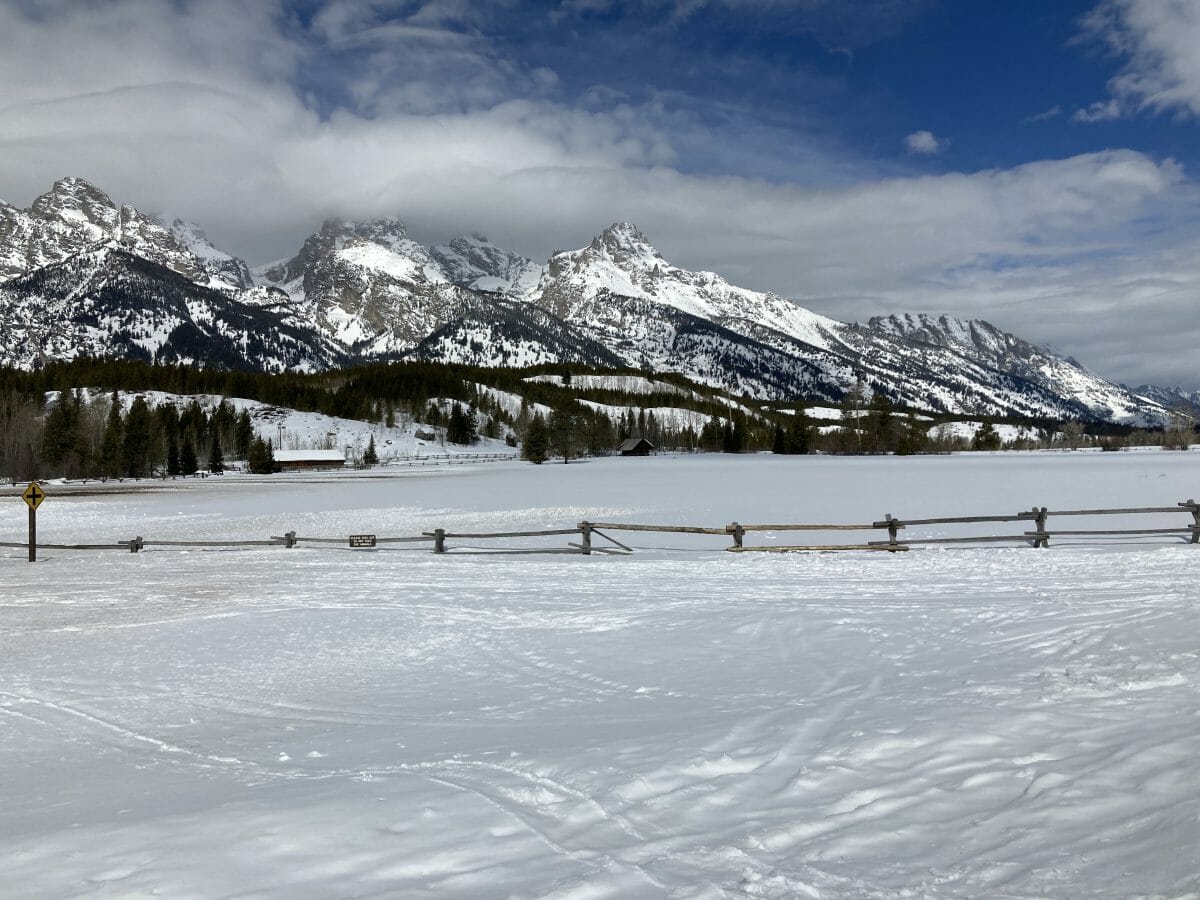
One of the most iconic places in the west–the Taggart Creek Corals and the Grand Teton–this time hidden in the clouds. Spring is around the corner hastened by daylight savings time…. Stay tuned!
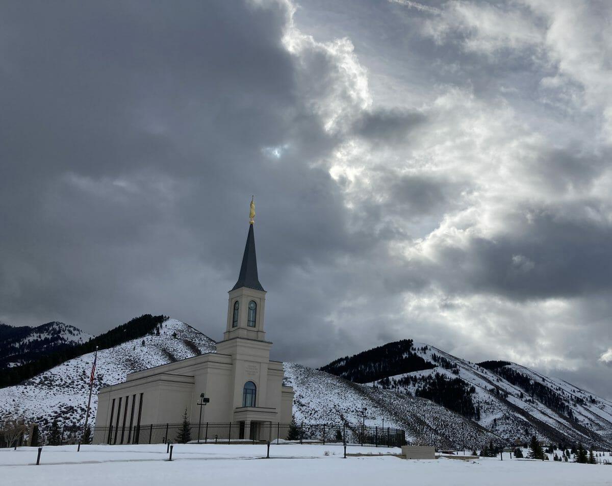
Driving south through Star Valley–one of the most beautiful areas of our country, churches line each side of the road–almost like Wall Street– and now interspersed with Wells Fargo Banks which finance the subdivisions of all the ranch land. Fifty years ago, I drove my 65 VW bug down this valley and watched the farmers drive their horse-drawn sledges full of hay. Those days are long gone.
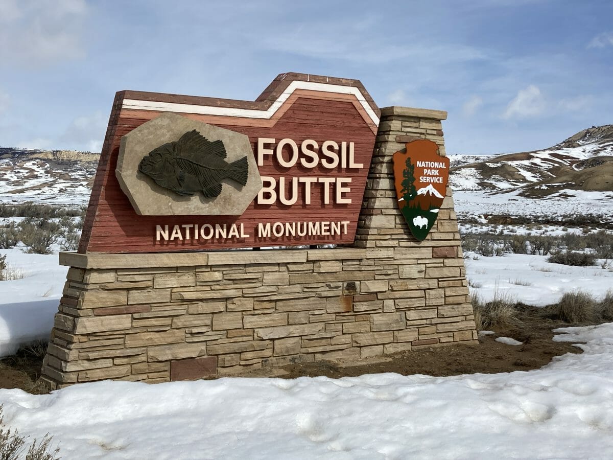
Park #190 for Ranger Doug–this is another incredibly interesting place if you like parks, geology and paleontology. The geologic timescale from creation of the planet to modern man is illustrated on the handrail as you enter the visitors center from the parking lot–it’s a long but informative walk. Fossil Butte (once a very shallow lake bottom the size of half of Utah) is one of many remnants of the mid-continental ocean that flipped from fresh to salt water creating catastrophic die-offs and preserving a wonderful Eocene paleontological record–not just fish but crocs, turtles and even beaver. I’ll return to get the whole story;.
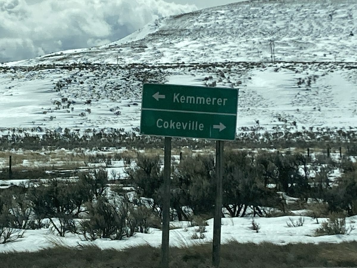
I chose Kemmerer–the Kemmerer family just bought the Jackson Hole Ski resort and rebuilt the tramline from tower-up. My salute to this family but my admonitions for developing fossil fuels. The landscape is littered with gas wells
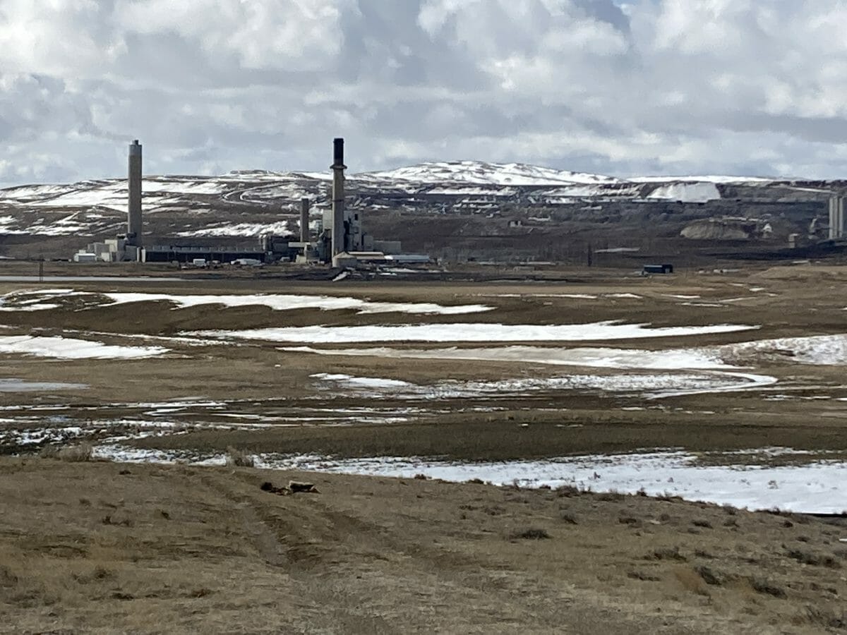
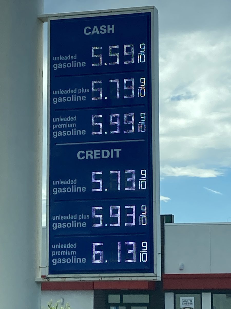
I know not what this “factory” is, but it’s right out of Star Wars and must be evil. And in the middle of nowhere.
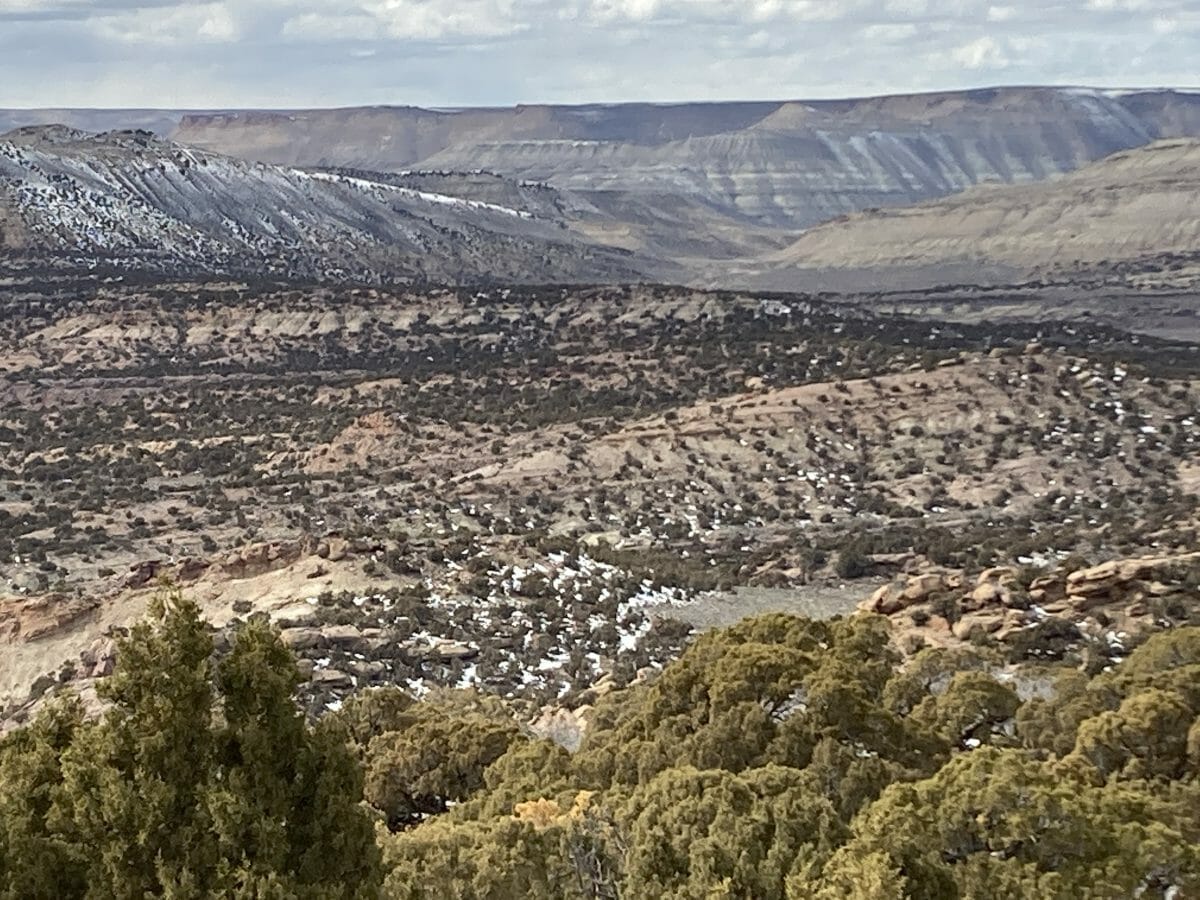
Flaming Gorge–the Green River cuts south through this uplift–similar to the Grand Canyon–on the eastern edge of the Uinta mountains–the only mountain range in the US that runs East-West. John Wesly Powell ran this river, not once, but twice–in 1869 and again in ’71 when he gathered more geological information. Sponsored by the US Geological Survey, of which he became head in 1881-4. He later became the first head of the Bureau of Ethnology of the Smithsonian. And he had one arm–the other lost in the Civil War. Where are the Powell’s of today? Maybe he’s related to C. Don Powell, the artist behind our National Park poster art?
I proceed south to Monument Valley.
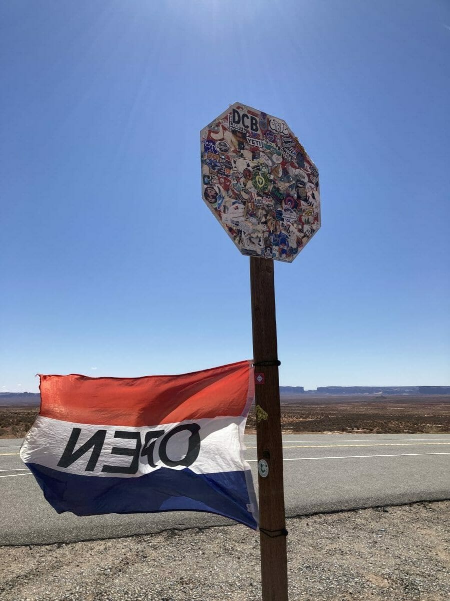
This stop sign used to say “stop.” Now it says open. Navajo jewelry stands line this spot–the most beautiful place on earth. Sharing my experiences at Phoenix Indian Medical Center in 1978 and my later public health work in Alaska, the Navajo jewelry seller leaned in close and said: “We have a name for this scared place…….it’s called the Forrest Gump Highway.” So much for restoring the Navajo language.
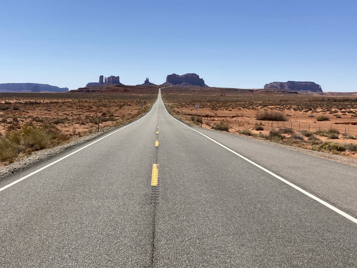
The Forrest Gump Highway. Quoting from the New York Times: A bit like Forrest Gump, Mr. Leen has an uncanny way of running into historically significant people and objects.” So this has become my highway of sorts–I detoured this trip a few hundred miles just drive this and admire the vistas. (The mesa on the right is called Eagle Rock mesa. In 1970, Fred Becky and I tried to climb the spire on the right side of this mesa–barely visible–Eagle Rock Spire. It was the same time of year–March and windy and cold (about 35F I recall) and our ropes got shredded by the wind. We gave up but I believe Eric Bjornstad and Fred completed this climb the following year. Eric–a book-worthy mountaineer alongside Fred, is pictured here in about 2006
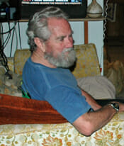
There was only one Eric Bjornstad–movie star good looks and a prolific rock climber. He ran the Eigerwand Coffee House in the U-District in Seattle in the early ’60s.
The drive from the east into Moab is spectacular with the Titan Towers and Castleton Towers begging constant glances while driving this tortuous road.
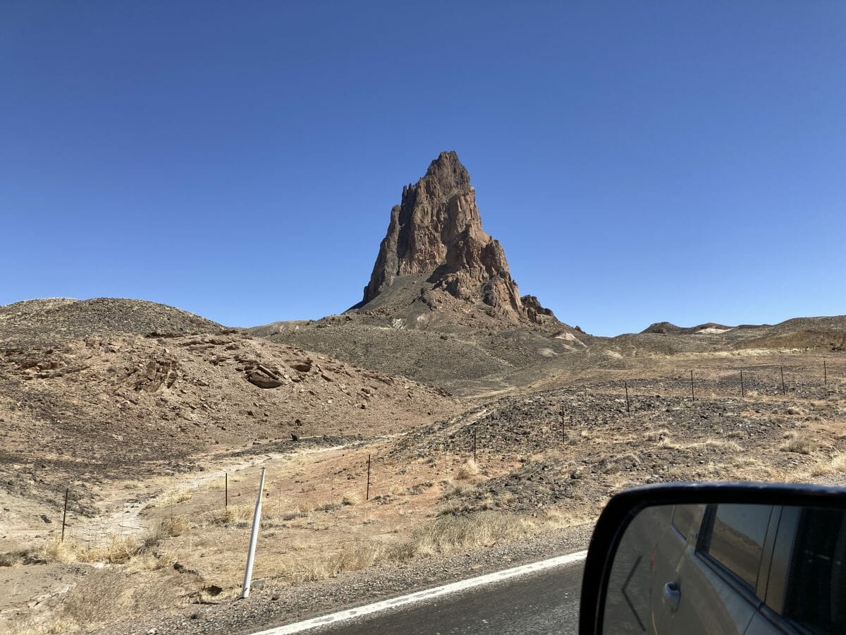
Leaving Moab, the landscape is littered with old volcanic plugs that pierced the sandstone beneath. This is a minor one just before entering Keyanta. Ship Rock near Four Corners is the grand-daddy of them all–first ascent Fred Beckey and Eric Bjornstad!
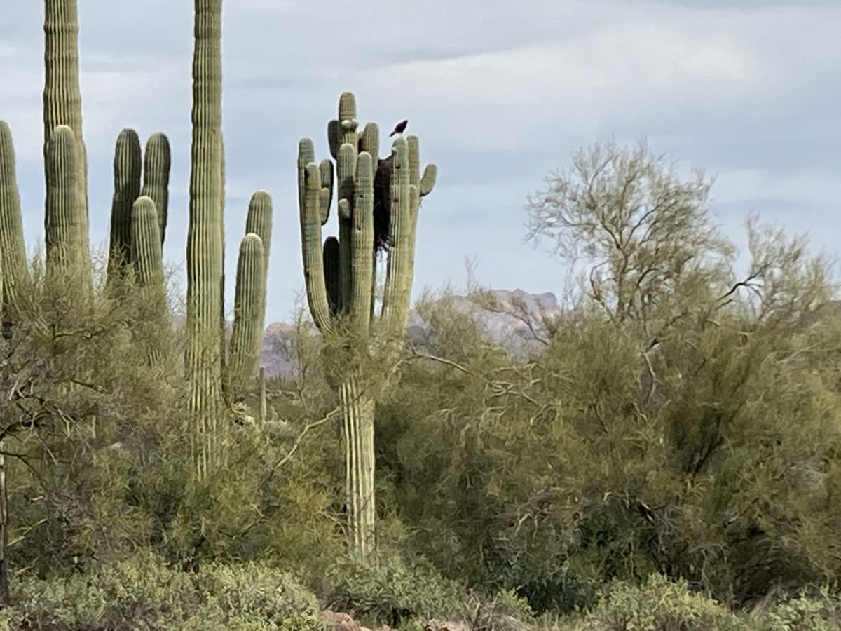
Saguaro country. Such beasts are over 200 years old here–as old as the Alaska Yellow Cedars–birds then nest in them–here a hawk–they jamb up the limbs and use these nests each year.
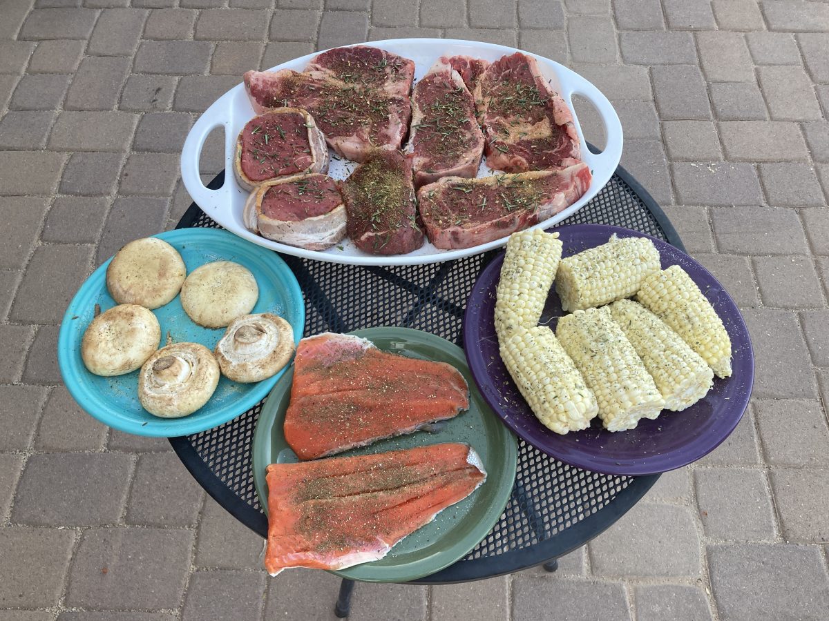
I look up old friends and we feast on Alaska sockeye salmon and beef. Life is good.
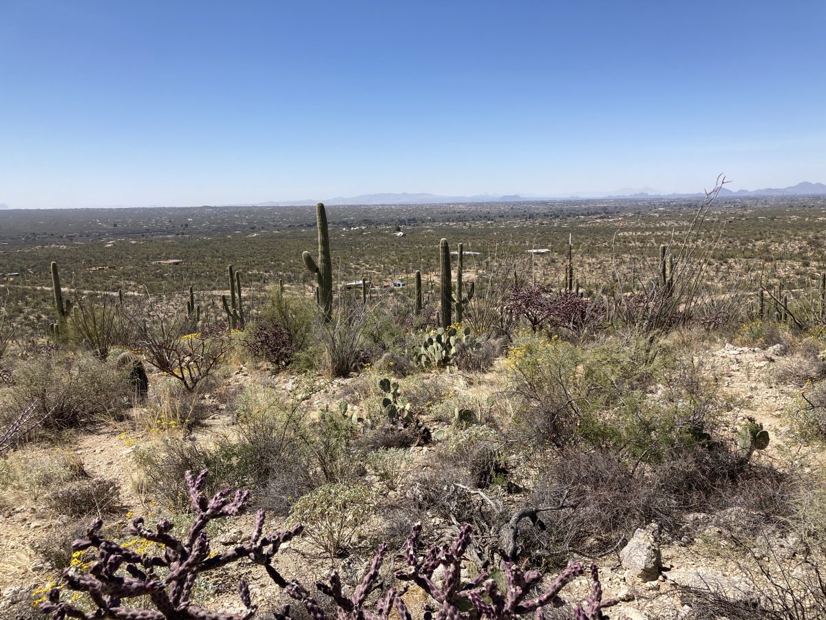
The Sonoran desert is unique. The Tucson basin is a bit like Jackson hole–surrounded by mountains but tilting the other way–uphill to the south. To the east & west, are Saguaro National Park units–the eastern unit established first. The Catalinas are NE of Tucson partitioning Oro Valley from the park. A small range to the south completes the “Jackson Hole” of Arizona. Tucson is 1500′ higher than the Phoenix basin and cooler. Nogales (Mexican border) is another 1000′ higher to the south.
I’m looking for land (or a house). But the problem is Tucson is built out to the foothills and beyond–here is a driveway ascending to a 2 acre property–unacceptable access. Beautiful views but 25 miles from Tucson–$225,000. This is more than I make in a week, or a month, or a year…….
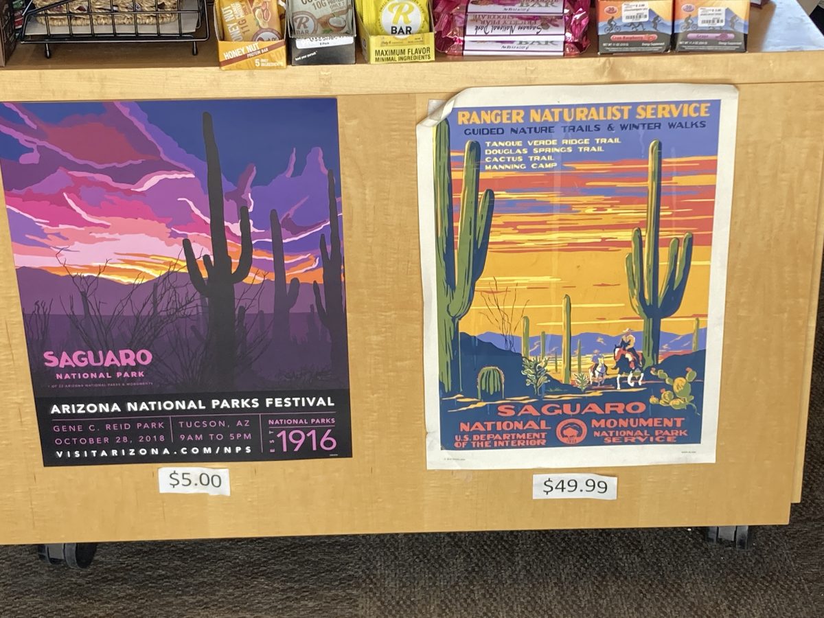
Of course, I visit the parks (Saguaro here) that sell my prints–beautiful display here alongside a $5 on-demand printed print. Mine is dog-eared and has a huge stain running top to bottom and priced at $50. I wouldn’t buy this! Time to hold onto the reigns of park marketing.
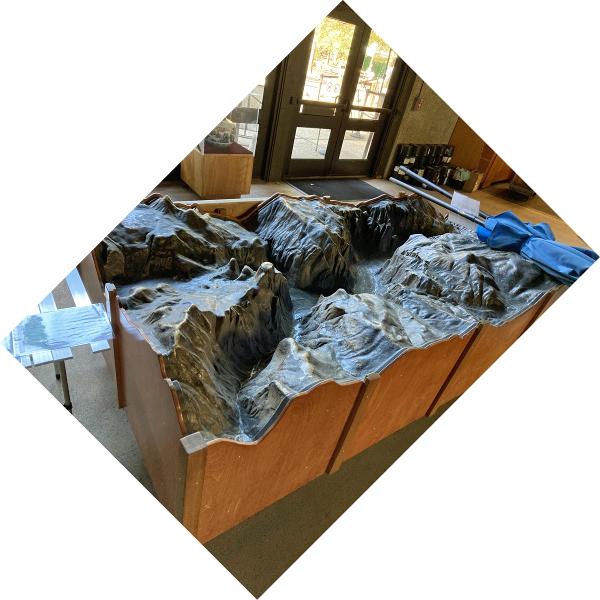
After a week in Tucson, it’s time to saddle up the horse and pee on the fire. Off to Yosemite to locate the 40′ relief map that sits languishing in an El Portal warehouse.
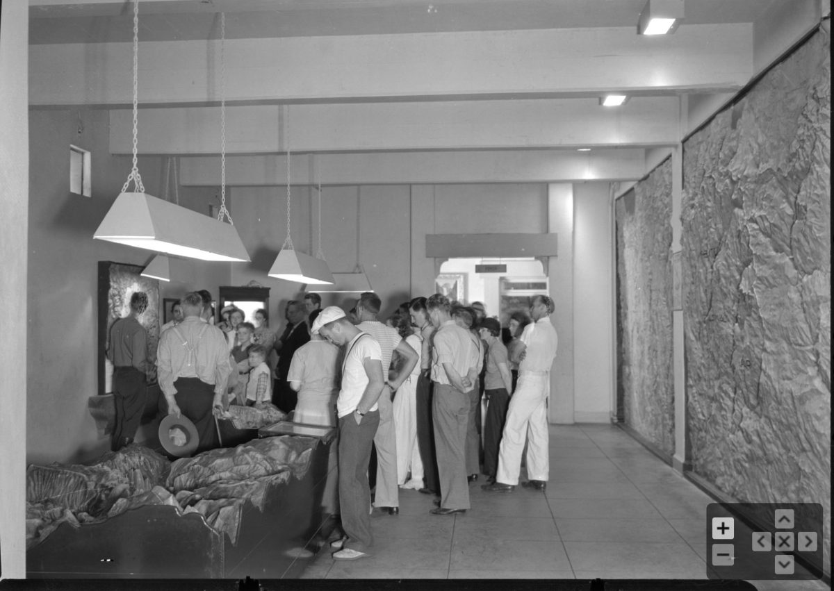
Today it languishes in a warehouse….waiting to be restored and revealed once again by the “Ranger of the Lost Art.” Note in the above photo to the right–the large exaggerated scale valley map. It is still in use today:
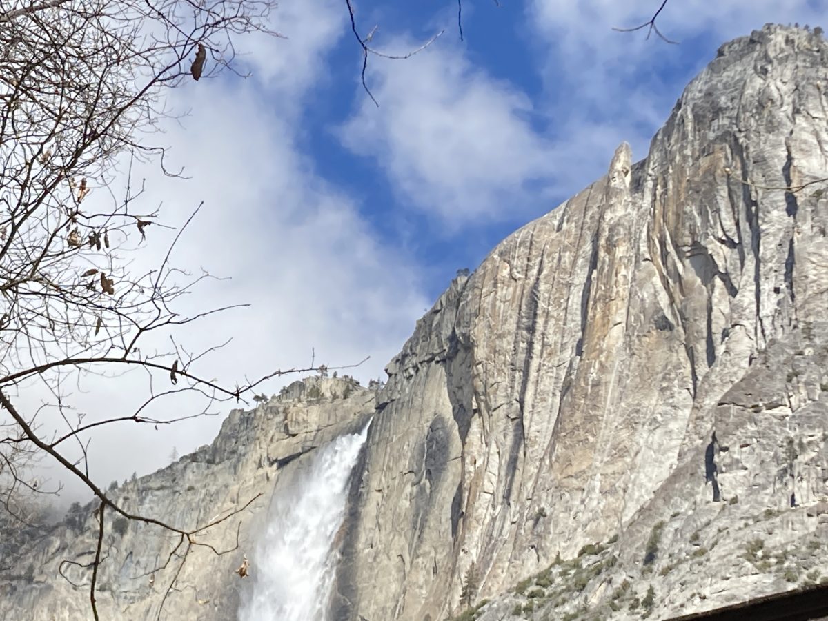
The Yosemite Museum today–Yosemite Falls roars 2500 feet above.
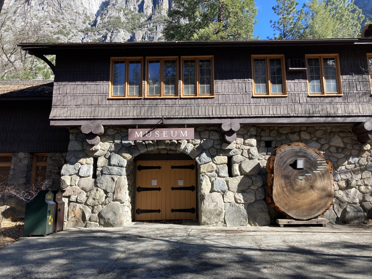
From Wikipedia: The idea of establishing park museums to promote outdoor education had national support in the 1920s, and the Yosemite Museum was a direct beneficiary. The Committee on Museums in National Parks, set up by the American Association of Museums, presented proposals for such museums to the Laura Spelman Rockefeller Memorial, and two awards were made. One was a grant of $70,500 to build and equip a museum in Yosemite to serve as a model for this type of facility. The building was completed and presented to the NPS by the American Association of Museums in 1925 and was opened to the public in 1926.”
Lost Arrow Spire–to the right of the falls–stands sentinel. In the 1960’s, Warren Harding (the climber, not the President), bolted an entire route up the entire route from the valley floor (this summit us usually climbed by “Tyrolean Traverse.” To hasten this monumental project, he filed Chouinard Bat-hooks down to fit superficially drilled bolt holes and literally inched his way upward. Fred Beckey and I employed the same technique on the first ascent of the East Buttress Direct of the South Early Winter Spire in Washington Pass.
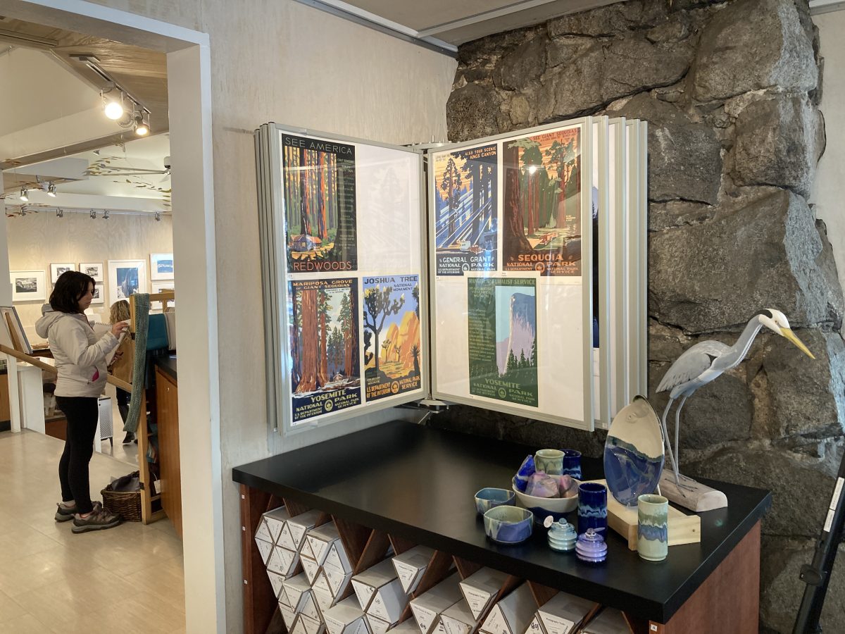
My posters have their own corner in the Ansel Adams Gallery in Yosemite–probably our most prestigious display (compare with Saguaro National Park above). Some of my competition claims inspiration from Ansel Adams himself for their knock-offs of my work. Adams never was a WPA artist and maintained a gallery here–just setting the record straight.
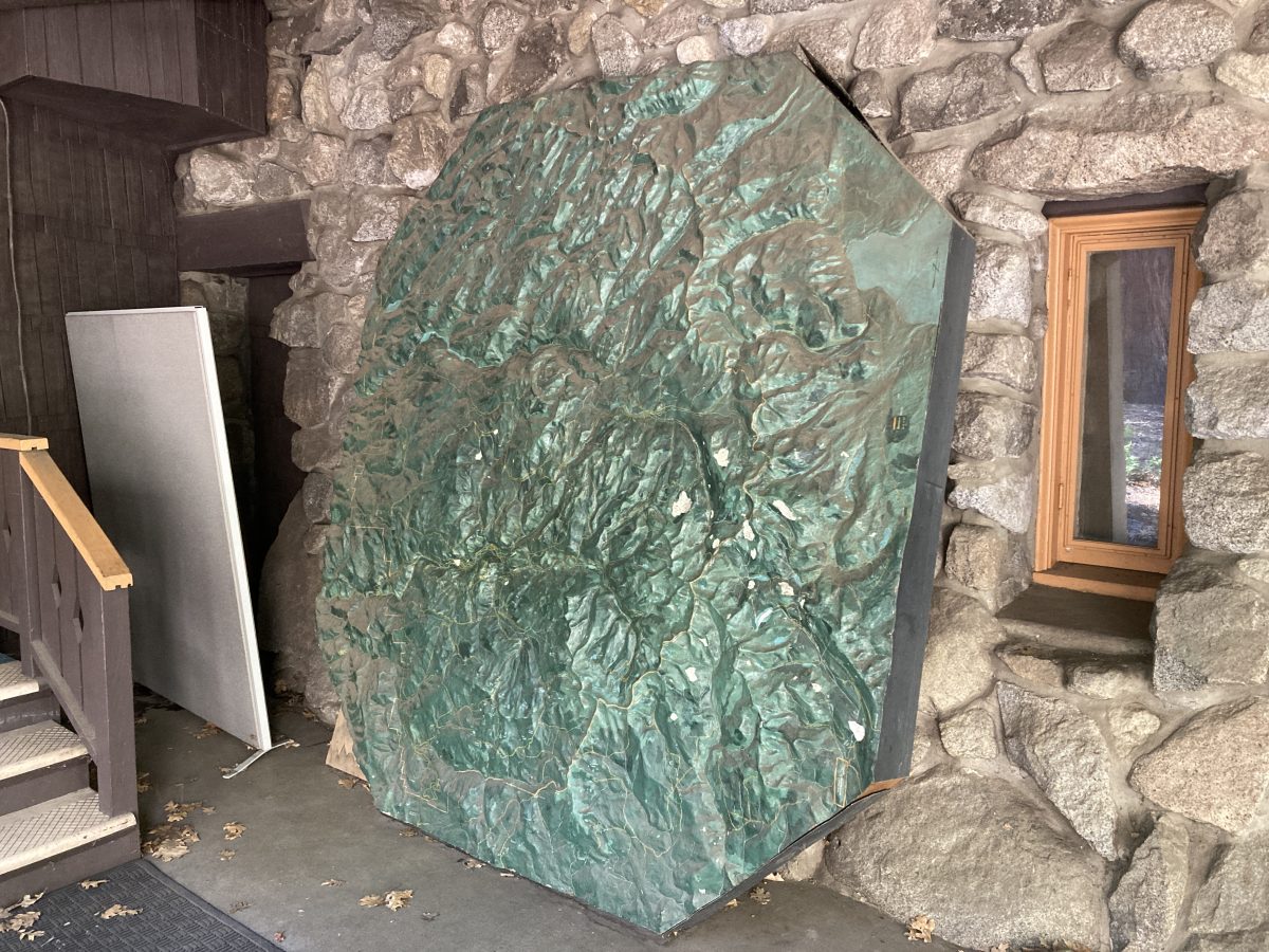
One surprise find was this 8′ miniature relief map made in approximately 1939 (before the WPA era) for the museum. It will be repurposed to another loation.
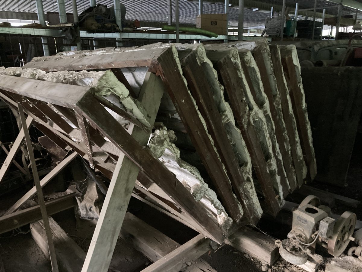
My main quest–this 40′ long relief map of the entire Sierra front. This was built in 1934-5 under the auspices of Ansel Hall, then Chief of Interpretation at Yosemite, by CCC workers at the Strawberry Canyon Camp SP-10. I’m trying to find interested individuals to help restore this.
The drive back to Seattle was uneventful and I’m glad to be “camped” in my warehouse Airstream and out of cheap hotels. BTW–the Ahwahnee Hotel room rates are now $750/night and this is in March! Times have changed.
Stay tuned!